Day 1.
Weather in Tikhaya Bay
+12°C/+54°F
26.07.2026
clear
Humidity
90%
Wind
1.1 km/h
High
+15°C/+59°F
Low
+11°C/+52°F
Preparation
Essential gear includes comfortable footwear — hiking boots or sneakers with a good tread. Ideally, they should be waterproof or quick-drying. You’ll also need storm-proof clothing — a waterproof jacket and pants. For your head: a cap, hat, or sun hat. Don’t forget to pack a headlamp, raincoat, insect repellent, flares, and a sufficient supply of food and drinking water. For a comfortable trip, we recommend bringing at least 3 liters of water per person. Keep in mind that there will be no places along the route to refill drinking water. Before setting off, make sure to register your route with the Ministry of Emergency Situations. You must submit your application at least one day before departure — through the MChS website, by mail, or in person at a regional office in the Sakhalin Region.
Website: forms.mchs.gov.ru
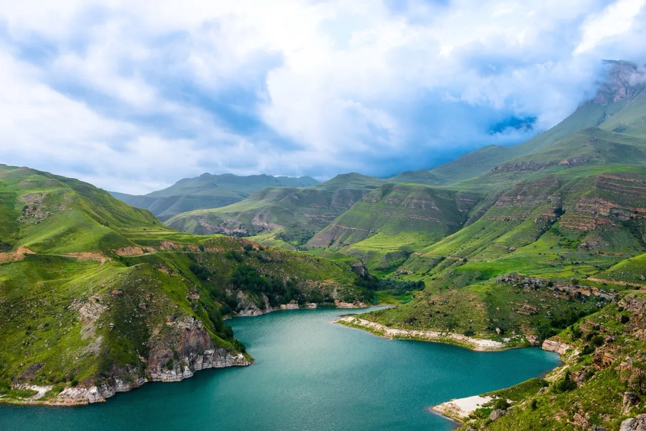
Tikhaya Bay
The starting point of the route The bay lies within Russia’s first national nature park, “Cape Tikhiy.” There is a parking area for cars, a tent camping zone, and an eco-tourism complex called “Tikhaya Bukhta,” where visitors can stay overnight and even enjoy a sauna. This is where the trail to the “Dragon Ridge” begins. According to legend, the ridge got its unofficial name from an Ainu myth, which tells of a dragon-like creature that fell asleep on the seashore. Tikhaya Bay is located near the middle of Terpeniya Bay, stretching just 2 km between Bold Peak and Cape Tikhiy. It is one of Sakhalin’s most scenic locations, popular among both mainland travelers and locals.
Address: Coordinates: 48°00′49.41″N 142°32′11.89″E
Cape Tikhiy
The next stop on the route You’ll reach Cape Tikhiy along a pebble beach. The cape shelters the beach from the wind, making the sea calm and shallow. From the beach, climb the ropes leading up the ledge to the entrance of the namesake park “Cape Tikhiy,” covering an area of 29 hectares. Ahead, you’ll encounter dark coniferous forests, exotic Far Eastern plants, and mesmerizing coastal views framed by volcanic cliffs and mineral formations. These places still preserve the memory of the Ainu people — the ancient inhabitants of Sakhalin.
Address: Coordinates: 48°01′23.98″N 142°32′46.88″E
“Ainu Cabin”
The first modern structure built using traditional Ainu construction methods in over 75 years. The raised storehouse on 1.5-meter stilts was built in 2020 by volunteers and activists of the “Cape Tikhiy” Nature Park. The structure was created in the same proportions, from the same materials, and using the same construction techniques as those employed by the ancient Ainu people. Such granaries, or “utility huts,” were built next to residential houses and used for storing food for the winter — keeping meat, hides, and hunting tools safe from wild animals and rodents. The “Ainu Cabin” is open to travelers: inside, you’ll find information plaques about rare plant species listed in the Red Book that grow within the territory of the national park.
Address: Coordinates: 48°01′26.54″N 142°32′49.13″E
“Sphinx” Rock
A solitary stone formation Following a well-trodden path, you’ll reach the next landmark — “Sphinx” Rock, named for its resemblance to the Egyptian monument. Shaped over time by wind and rain, the Sakhalin “Sphinx” is a masterpiece of natural sculpture. Here you’ll begin to see dwarf Siberian pine shrubs, initially in small clusters, becoming denser as you ascend. The rock is a sacred site of the Ainu people, located near the Zhdanko Ridge. From here, you can already see the ridge’s peaks and trace the path ahead. The Ainu believed that only those pure of heart were permitted by the spirit Tosso — their name for the ridge — to climb to its summit. Such travelers would always find their way open, enjoy good fortune, and experience enlightenment at the top.
Address: Coordinates: 48°01′40.88″N 142°32′54.47″E
Zhdanko Ridge Summit
682 meters above sea level Beyond the rock, the trail continues through forest and tall grass before reaching a rocky crest that leads directly along the ridge. From the summit of Zhdanko Ridge, breathtaking views unfold: to the east lies the vast expanse of the Sea of Okhotsk, part of the mighty Pacific Ocean; to the south, mountain peaks rise, composed of volcanic rock. Take your time here — absorb the moment, and feel the majesty of Sakhalin revealed in all its splendor.
Address: Coordinates: 48°03′40.67″N 142°31′49.28″E
Tsapko Station
The northern return route You’ll return along the northern trail, ending at Tsapko Station. The route follows the ridge, passing Mount Vladimirovka — another peak of the Zhdanko chain, 593 meters high — then, after about 1.5 km, it sharply turns left and descends toward the station. From Tsapko, you can take bus No. 502, which runs between Poronaysk and Yuzhno-Sakhalinsk. Tsapko and Tikhoye are neighboring stops, so if you left your car at the bay parking area, you can return to retrieve it using the same bus. The bus runs up to five times a day, so be sure to check the schedule in advance and confirm the time of the last trip toward Yuzhno-Sakhalinsk.