About
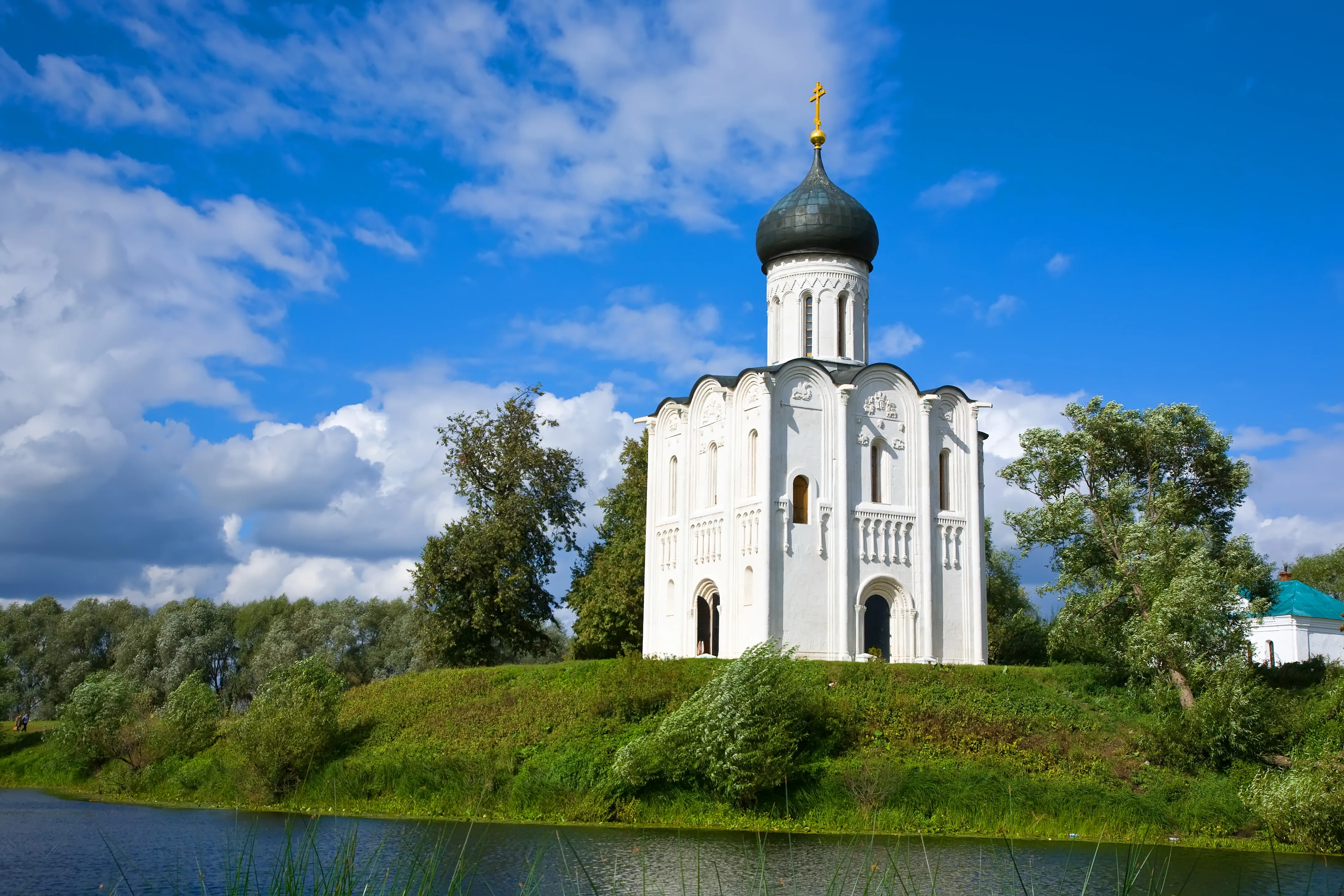
A gem of white-stone architecture The church was built in the 12th century. It stands in the middle of a meadow on an artificial hill, on the bank of the Nerl River. During the spring flood, the church remains on a small island surrounded by water. Carved bas-reliefs with faces, animals, and birds are preserved on the facade.
Coordinates: 56.19625, 40.56135
Mon–Sun, 10:00 am‑6:00 pm
Open a map on your phone
Scan the QR code to open the address in your phone's maps


ANO National Priorities uses cookies (files storing data on past website visits) to personalize services and improve user experience. ANO National Priorities treats personal data protection seriously — please review the terms and principles of processing. You can disable cookie storage in your browser settings.